PATH SNOW TREK - Lago delle Fate
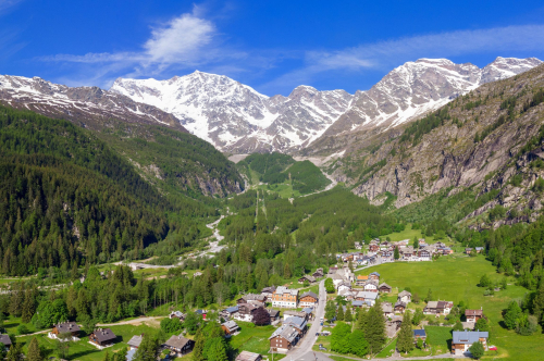
An easy snowshoe hike through enchanting woods to the entrance of Val Quarazza and its splendid and magical Lago delle Fate
Place of departure: Macugnaga, loc. Pecetto (1369 m.)
Place of arrival: Lago delle Fate (1330 m.)
Minimum altitude: Isella (1240 m.)
Height difference: -130 m +85 m one way
Distance: 4 km one way
Travel time net of stops: 1 hour 30 minutes one way
Signage: yellow signs "Lago delle Fate/Val Quarazza"
How to get there: 49 km from Gravellona Toce. Strada Statale 33 del Sempione, Piedimulera exit. Follow Strada Statale 549 of the Anzasca Valley to the municipality of Macugnaga and its hamlets.
The itinerary:
The route starts at the bottom of the car park located at Pecetto in the chairlift forecourt (paid parking). After passing the skating rink, the asphalt road continues downhill. After crossing the bridge over the Anza stream, the path is no longer cleared of snow and it is possible to put on your snowshoes.
Take the wide beaten track to the left, which is initially flat and then descends steadily and continuously through the thick forest, passing several isolated buildings in the hamlet of Opaco. Pass the hamlet of Staffa, whose houses peep out to the left across the stream, and when you arrive near Isella, you reach the lowest point of the entire route.
Once in Isella, you will come to a fork with a sign indicating the path to the right taking to the Lago delle Fate. The wide road is initially flat and then slowly begins to climb until reaching the beautiful hamlet of Motta, on the left; continuing on the route, which becomes flat again, you arrive at the first dwellings of Val Quarazza, which are just a few maters from the small church dedicated to San Nicola, rising above a few steps on the right, while on the left, after a short climb, the suggestive Lago delle Fate (Fairy Lake, usually frozen) appears.
The route continues on to the lake, but it is advisable not to go too far into the Val Quarazza.
The return journey is by the same route as the outward journey.
Tips for baby snowshoers
Easy route, also suitable for children and beginners. In certain snow conditions, it is also possible to go without snowshoes. It should be borne in mind that the return journey has a greater incline than the outward journey. With younger children, it is possible to shorten the hike by starting from the hamlet of Isella, where there is a large car park (in this case 2 km, +85 m difference in altitude, 1 hour one way).
CONTACTS FOR TOURIST INFORMATION
IAT OFFICE MACUGNAGA
Piazza Municipio, 6 – 28876 Macugnaga (VB)
Tel. +39 0324 65119
Email: iat@comune.macugnaga.vb.it
www.macugnaga-monterosa.it
Path Makers: Franco Voglino, Annalisa Porporato e Nora Voglino
Authors of text: Franco Voglino, Annalisa Porporato
The path is described in the book “SNOW TREK” of Distretto Turistico dei Laghi – edition 2021
The routes were suggested by ski operators and municipalities Partner of Neveazzurra project. We decline any responsability regarding the effective feasibility and any changes that the routes can suffer. Maps and tracks are purely indicative of the route.
Safety annotations:
Here are some practical tips: find out about weather and snow conditions, checking the forecasts especially at local level; check the avalanche bulletin for the relevant area; equip yourself with and carry PSA self-rescue equipment: shovel, probe and ARTVa; wear warm, waterproof clothing that is comfortable and consists of several layers... despite the snow, you will get warm as you move; hiking shoes or mountain boots depending on the area, terrain and altitude where the hike takes place; bring gloves, cap, sunglasses and sunscreen; pack a rucksack with a spare shirt and hot drinks; during the hike, always check the slopes above you; avalanches usually break off on slopes with a gradient of more than 25° and can also continue on flat sections.
45.970958453171, 7.9520416259766
45.970958453171, 7.9520416259766
Nearby
Discover places, experiences and activities in nearby locations


