PATH SLOW TREK - The ancient villages of Domodossola
A circular walk of easy to moderate difficulty starting in centre of Domodossola and leading to one of the Sacri Monti (a UNESCO World Heritage Site). The path goes through the ruins of ancient villages in what used to be the municipality of Vagna.
Departure and arrival location: Domodossola railway station (270 m)
Maximum altitude: Vallesone (670 m)
Difference in altitude: About 400 m total
Distance: 8 km total
Walking time not counting stops: 3 hours total
Type of route: mixed (trail, asphalt, cobblestones, dirt road)
Signs: road signs and red/white marks
Water: fountains in Domodossola, at Sacro Monte Calvario and in some of the villages
Recommended period: all year round, without snow
How to get there: at the Domodossola train station there are free or paid parking spaces. By bus: connections to the main locations (www.comazzibus.com). By train: Milan-Domodossola and Novara-Domodossola lines, connections also with Switzerland (www.trenitalia.it)
Information: Distretto Turistico dei Laghi www.distrettolaghi.it; IAT Office - Piazza G. Matteotti, Domodossola, tel. +39 (0)324.248265; Municipality of Domodossola www.comune.domodossola.vb.it; Sacro Monte Calvario www.sacrimonti.org/en/sacro-monte-di-domodossola / www.sacromontecalvario.it
the itinerary
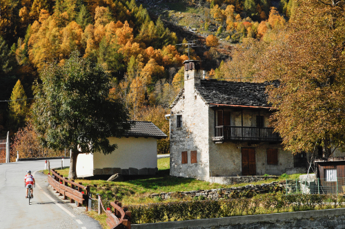
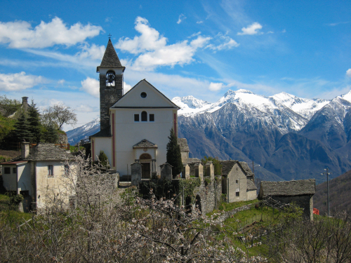
From the Domodossola train station, take Via Ferraris, which leads towards the the centre. You won’t enter the real city centre now (you will when you return) but you come close to it on the street Via Fratelli di Dio, which then becomes Via Garibaldi. Cross the triangular Piazza Tibaldi and take Via Rosmini (red/white signs for Sacro Monte Calvario). This street turns into Via Mattarella (yellow signs for Monte Calvario Via Crucis). When you are almost at the base of the hill, you’ll see the first chapels of the Sacro Monte complex, which seem to be a little swallowed up by the city traffic. Only after the third chapel will you start to finally climb up a wide steep cobblestone road, which is closed to most traffic. This is the beginning of a journey back in time, marked by the chapels of the Sacro Monte, which were built starting in 1657. Each one is different from the others, and inside them, life-size statues portray the story of the Christ’s walk to Calvary. Today, this Sacro Monte complex is classified as a UNESCO World Heritage Site. At the height of the sixth chapel, you must keep to the right, and stay on the main cobblestone pavement. After you reach the Sacro Monte, turn left and enter through the gate that leads to the entrance to the Sanctuary and the Convent. You will get to a beautiful garden (with rest rooms and benches) that surrounds the tower and the ruins of the 6th century Mattarella castle, of Lombard origin, which was destroyed in the 15th century. Here, you have a bird's eye view of Domodossola (413 m). Go back to the Sacro Monte area, enter the car park and then climb up the stairs on the left (sign for San Defendente A01a) which leads to a beautiful uphill cobblestone road. When you turn around, you can see a pleasant view of the Sacro Monte complex. When you get to an asphalt road, cross it and continue on the cobblestone road (sign for San Defendente A01a) which leads, first, to another uphill stretch and, after that, to a small bridge on the right. If you go straight on, you will enter a steep path that leads through the woods directly to the Church of San Defendente. The path is much more gradual if you go over the bridge on the right and take the asphalt road uphill. This road has wide curves, and reaches the Cappelletta di Marisch first. Then, it goes up to the white Church of San Defendente (549 m). The path you want is right in front of the building (sign for Vallesone). After a pleasant start, the trail starts climbing steeply in the middle of a beautiful beech forest. You must be careful to take the only obvious trail at the fork: go left to get to the asphalt road. Follow the asphalt road to the right, pass in front of a votive pillar and you will come shortly to the village of Vallesone. This village is quite characteristic, with a fountain (untested water) and a giant wooden press. There are also many silhouettes of children and animals peeping out from the most unlikely places. This is the highest point of the entire route (670 m). Go past the Oratory of San Gaudenzio. After the village, just before the intersection where the bus stop is, take a dirt road on the right and go downhill (sign for Motto). Soon, you’ll have to leave this road and take a path on the left (sign for Andosso). The following route is very pleasant and gradual, and leads to Andosso (there’s a water fountain behind the white church). Cross the village and stay on the steep downhill dirt road on the right (sign for Prata D03a). On this path, hikers will cross a beautiful forest on the side of the hill, and then ford a small stream. After this, the path becomes less steep and leads to Prata. In the middle of the village, there is a washbasin made from an old oven, and at this point be careful and go right, downhill (the sign for Vagna is slightly hidden). On this path, you will come to the church and then continue on a beautiful mule track that passes right next to it (the sign for Vagna is near the ground). Walk along the descending mule track, and pay close attention to the red/white rectangular signs and the old round red marks. This path leads to Maggianigo, the old capital of the ex-municipality of Vagna. Hikers will need to go towards the church (428 m) which can be easily seen. Pass it and take the mule track to the left (sign for Domodossola). Both the mule track and the path descend steeply with narrow zigzags, to reach the outskirts of Domodossola in Via Ceschi. Turn right on Via Chiovenda, and at the end of it turn left onto Via Vanoni. Cross Via Salvo D'Acquisto and continue along Via Vanoni until you reach Via Di Vittorio. From here, turn right towards the roundabout (be careful: there is no pavement/sidewalk!). At the roundabout, go straight on along Via Giovanni Mauro and pass in front of the hospital. At the first traffic light, turn left to enter the historic centre, then turn right. The centre of Domodossola, a pedestrian area, is a lovely example of medieval architecture made up of exquisite buildings, small squares and narrow alleys. Wander through them all to discover the main city monuments, such as the 18th century Collegiate Church of SS Gervasio and Protasio, the 15th century arcades of Piazza Mercato, and the buildings Palazzo Silva and Palazzo San Francesco. After passing through the old town centre, hikers will finish their walk by returning to the railway station.
to learn more
Vagna
Vagna was an autonomous municipality that grouped together the villages on this itinerary. In 1928, it was annexed and incorporated into the municipality of Domodossola. A piece of trivia? The “Festa dul Bambin”, literally the Feast of the Child - another name for Christmas - is celebrated in... July! It seems that this tradition dates back to the 17th century, when the heads of families were away from home during Christmastime and for this reason, they obtained permission to celebrate the birth of Jesus in the summer.
tips for young hikers
Accessible for pushchairs only from the train station to the Sacro Monte, and then in the historic centre. Fountains are located in the villages but often the water has not been tested.
Trail creators: Franco Voglino, Annalisa Porporato and Nora Voglino
Content authors: Franco Voglino and Annalisa Porporato
46.115460955797, 8.2960510253906
46.115460955797, 8.2960510253906
Nearby
Discover places, experiences and activities in nearby locations


